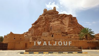
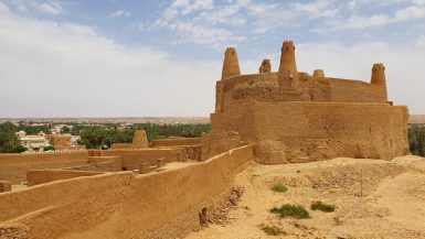
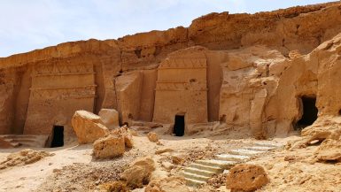
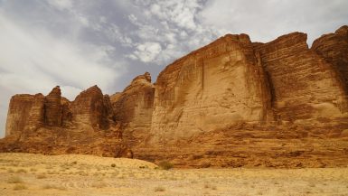
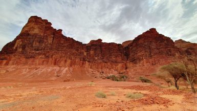
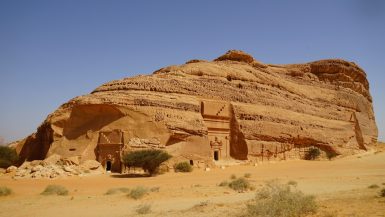
Tag - Archeological Site

KHANZAD CASTLE

Khanzad Castle, also called Banaman Castle, is located on the road between Erbil and Shaqlawa. It was constructed during the time of the Kurdish Soran Emirate in the 16th century under the rule of Princess Khanzad and her brother Prince Suleiman Beg. For seven years, she ruled over two...

SHRINE OF RABAN BOYA

Shrine of Raban Boya It is situated in Shaqlawa at the foot of the Safeen Mountains. Christians know the cave as Rabanboya, while Muslims call it Sheikh Wso Rahman. We took a taxi to the parking (10000 IQD), and from there, we hiked for around 20 minutes the steep hill up to the cave. It...

KHINNIS RELIEFS

Our last stop today was an Assyrian archaeological site Khinnis, also known as Bavian (🎫 5000 IQD), facing the River Gomel Su. There are remains of rock reliefs built by king Sennacherib around 690 BC. It was made to celebrate the construction of a complex system of canals whose aim was...

JERWAN

Just some two kilometers off the main road surviving pieces of an ancient aqueduct may have fed into the lost Hanging Gardens of Babylon. The muddy road is only for off-road vehicles. The aqueduct is part of the larger Atrush Canal built by the Assyrian king Sennacherib between 703 and...

HALAMATA CAVE (ئەشکەوتی هەڵەمەتا)

Our next stop was supposed to be Halamata Cave – an archaeological site near Duhok. The caves contain the Assyrian relief carvings known as the Maltai reliefs. The reliefs all show a procession of nine figures (the Assyrian king worshipping the main divinities in the Mesopotamian...

CHARSTEEN CAVE (ئەشکەوتی چارستن)

We drove from Zakho to the symbol of ancient Zoroastrianism – the Charsteen Cave. It is located just next to the Duhok Dam (🎫 1000 IQD). Fire, water, soil, and air were four sacred elements in Zoroastrianism. A short rocky tunnel leads to the sacred place – an open fire temple...

ANI

We drove 45km east of Kars to Ani ruins (🎫 50 TRY). We arrived there around 7 PM at large parking near the entrance. To our surprise, nobody was around that time, but to our luck, they left the toilets open. Ani lies east of Kars and along the Arpaçay River, which forms the border with...

CARAHUNGE (Քարահունջ)

Carahunge, also known as Zorats Karer or Dik-Dik Karer, or Tsits Karer, is a prehistoric archaeological site near the town of Sisian in the south of Armenia. The “Armenian Stonehenge” (🎫 1400 AMD) is located on a mountain plateau at an altitude of 1,770 meters near the canyon of the River...

KHNDZORESK (Խնձորեսկ)

We took the main road from Goris and then turned on a dirt road about 3km before the town of Khndzoresk. The bumpy road brought us to a viewpoint and a cafe (closed), as well as a squeaky 160m suspension bridge over the gorge. Dug into volcanic sandstone on the slopes of Khor Dzor (Deep...

GORIS (Գորիս)

We spent a night in the valley of the Vararak River in the town of Goris. The main attraction are the cave shelters of Old Goris carved into the hillside on the east side of town. They were probably built and inhabited in the 5th century. Several trails lead up over a saddle with epic...