Tag - Mountains

MATOBO NP

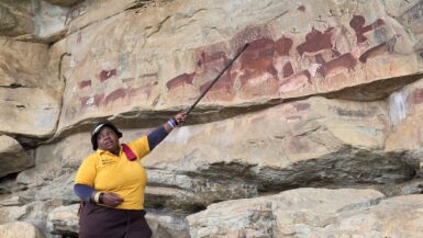
Today, we were invited by Ian Harmer (📞+263 772 224 069) from African Wanderer to explore Matobo National Park, located just 35 km south of Bulawayo. A UNESCO World Heritage Site, the park is renowned for its spectacular granite balancing rocks, extensive San rock art, and one of...

CAPE MACLEAR

We spent a day and a night at Cape Maclear after a 6-hour-long, tiring drive from Senga Bay along the severely damaged M10 road, followed by the final stretch on the S128 road, which was just as rough but even narrower and steeper. Cape Maclear is a stunning, laid-back fishing village...

LIVINGSTONIA

Perched high on the Rift Valley escarpment overlooking Lake Malawi, Livingstonia is a picturesque historic town renowned for its well-preserved colonial architecture, rich educational heritage, and sweeping panoramic views. Founded in 1894 by Scottish missionaries, it remains one of...

LAKE NYASA

We decided to take a day’s rest on the shores of Lake Nyasa before crossing the border into Malawi. Matema is a stunning and secluded lakeside town in southwestern Tanzania, nestled within the East African Rift Valley on the northern shores of Lake Nyasa (Lake Malawi). It is renowned for...

NGOZI CRATER LAKE

Lake Ngozi is an awe-inspiring emerald-green crater lake nestled within the Uporoto Ridge Forest Reserve, about 22 kilometres south of Mbeya at an altitude of 2.620 meters. Surrounded by steep, forested crater walls, it is Africa’s second-largest crater lake and one of the...

MBEYA & GREAT RIFT VALLEY

Mbeya is Tanzania’s vibrant “Green City,” nestled in the country’s southwestern highlands at an altitude of 1,700 metres. Known for its lush mountain scenery and cool climate, it serves as a major agricultural powerhouse and an important transit hub linking Tanzania with Zambia and Malawi...

DRIVE TO AMBALAVAO

After visiting the king, we drove back to Fianarantsoa (2 hours) and then continued in the morning to Ambalavao (2 hours). Drive involved navigating the narrow, winding RN25 (often paved but damaged) from the rainforest to the highlands, followed by the paved, scenic RN7. The 118+ km...

RANOMAFANA NP

In the morning, we went on a short three-hour hike in Ranomafana National Park (🎟️ 55,000 MGA, guide: 90,000 MGA, tax: 5,000 MGA), a 41,600-hectare protected tropical rainforest in southeastern Madagascar. The park’s geography is defined by steep, mountainous terrain ranging from 600 to...

ROVA D’AMBOSITRA

Serene, terraced rice fields, red-earth homes, and the intricate woodcarving traditions of the Zafimaniry people define rural life around Ambositra. We hired a local guide (80,000 MGA) and set off on a hike to Rova d’Ambositra (🎟️10,000 MGA), the former residence of the last Betsileo...

AMBOSITRA

We spent a day in Madagascar’s central highlands, in the historic heartland of the Betsileo people and a town often called the “Capital of Woodworking” for its renowned Zafimaniry art. Ambositra is a high-altitude city (1,342–1,422 m elevation) serving as the capital of...