Archive - April 2026

DRIVE TO TSARANORO

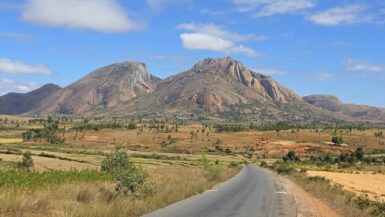
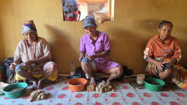
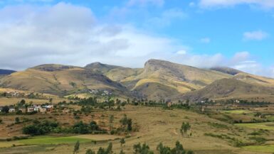
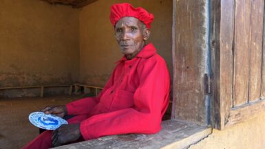
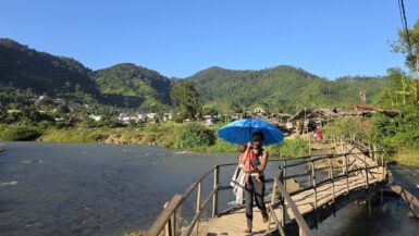
After visiting Anja Reserve, we continued our adventure to the remote Tsaranoro Valley. The road was really bad and required a tough 4WD vehicle to access the valley via a rough, sandy dirt road branching about 30 km off the main RN7 south of Ambalavao. The approximately three-hour drive...

ANJA RESERVE

Our next one-hour stop was Anja Community Reserve (Anja Miray), a remarkable 30-hectare community-managed forest reserve established in 1999. Located about 13 kilometres south of Ambalavao along the RN7, this highly successful conservation project has become one of Madagascar’s leading...

ZEBU MARKET

We made a brief stop at the zebu market in Ambalavao, Madagascar’s largest cattle market, held every Wednesday on a large, dusty hill at the southern edge of town along Route Nationale 7 (RN7). It serves as a bustling hub where thousands of zebus are traded, reflecting their crucial...

ANTAIMORO PAPER

Traditional Antaimoro paper production in Ambalavao is a centuries-old artisanal craft that transforms the bark of the avoha plant into beautifully handcrafted paper. Known for its durability and distinctive papyrus-like texture, this decorative paper is often adorned with pressed flowers...

WILD-SILK WEAVING

Wild-silk weaving in Ambalavao is a remarkable, sustainable tradition, largely led by women, that draws on the natural resources of the region’s Tapia forests. By harvesting wild silkworm cocoons after the moths have naturally emerged, artisans produce durable, richly textured textiles...

AMBALAVAO

In the morning, we arrived in Ambalavao, a picturesque Betsileo people town known for its charming wooden verandas and intricately decorated balustrades. Situated between Madagascar’s central Highlands and the arid southern regions, Ambalavao is dramatically framed by the towering...

DRIVE TO AMBALAVAO

After visiting the king, we drove back to Fianarantsoa (2 hours) and then continued in the morning to Ambalavao (2 hours). Drive involved navigating the narrow, winding RN25 (often paved but damaged) from the rainforest to the highlands, followed by the paved, scenic RN7. The 118+ km...

TANALA KING

In the afternoon, we drove about 30 minutes from Ranomafana National Park to visit Kelilalina, a traditional village offering an authentic glimpse into rural Malagasy life. Nestled within Madagascar’s lush highland landscapes, villages like Kelilalina are home to close-knit communities...

RANOMAFANA

We arrived in the relaxed and friendly village of Ranomafana late in the afternoon and immediately set out to explore it on foot. Vibrant, humid, and beautifully scenic, this southeastern Madagascan settlement is best known as the gateway to the 40,000-hectare Ranomafana National Park...

RANOMAFANA NP

In the morning, we went on a short three-hour hike in Ranomafana National Park (🎟️ 55,000 MGA, guide: 90,000 MGA, tax: 5,000 MGA), a 41,600-hectare protected tropical rainforest in southeastern Madagascar. The park’s geography is defined by steep, mountainous terrain ranging from 600 to...